Monitor Valley Project
Fuse Acquires 97 Placer Claims in Monitor Valley North Project, Targeting Lithium-Rich Clays in Nevada
Lithium Property
Tonopah, Nevada
100%
Ownership
770 Hectares
Total Area
97
Placer Claims
Overview
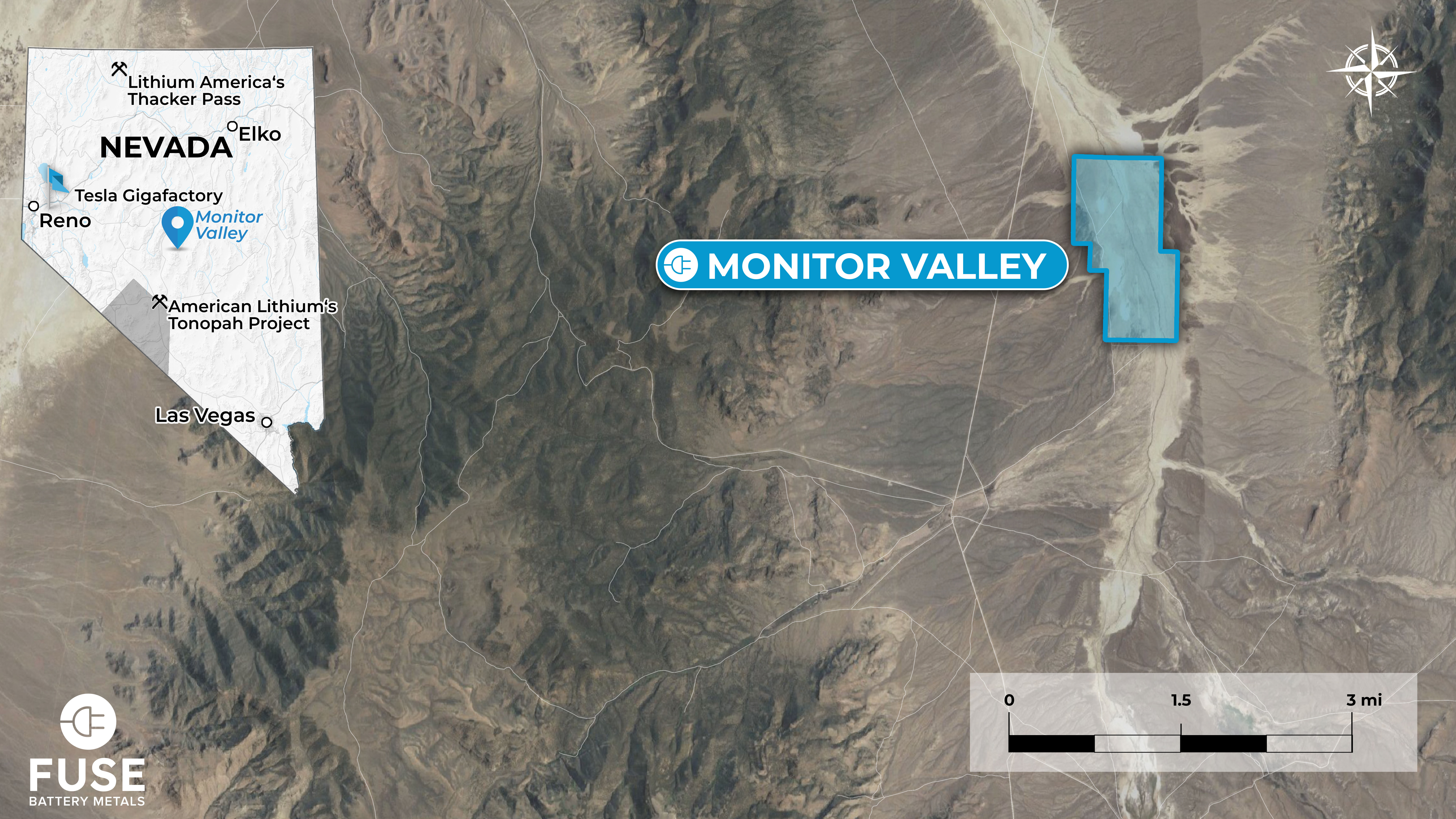
In March 2023, Fuse entered into a Purchase and Sale Agreement whereby the Company became the legal and beneficial owner of 97 placer claims (MVN1 – MVN97) covering approximately 770 hectares of alluvial sediments and clays located 134 km northeast of Tonopah, Nevada.
The property is located in Monitor Valley, Nevada, about 138 km north-northeast of Tonopah, Nevada. The center of the property is about 39.21° North Latitude, 116.65° West Longitude. The property is 55 km due west of the Little Smokey Valley, Nevada where exploration for lithium is ongoing.
The Monitor Valley North Project is a sediment-hosted lithium clay target. The property is easily accessible for exploration and exploitation to be carried out throughout the year. Although there has been minimal activity on the project, the initial surface samples collected during regional NURE sampling revealed an average lithium value of 664 ppm (with a maximum of 970 ppm and a minimum of 388 ppm) within a sedimentary sequence of Miocene mudstone and claystone. It is suspected that the origin of this lithium deposit is similar to the Clayton Valley clay deposits located about 180 km to the south. Both areas are reasonably well represented by the USGS preliminary deposit model, which describes the primary characteristics as light-colored, ash-rich, lacustrine (lake) rocks containing swelling clays.
In March 2023, Fuse entered into a Purchase and Sale Agreement whereby the Company became the legal and beneficial owner of 97 placer claims (MVN1 – MVN97) covering approximately 770 hectares of alluvial sediments and clays located 134 km northeast of Tonopah, Nevada.
Project Location
The property is located in Monitor Valley, Nevada, about 138 km north-northeast of Tonopah, Nevada. The center of the property is about 39.21° North Latitude, 116.65° West Longitude. The property is 55 km due west of the Little Smokey Valley, Nevada where exploration for lithium is ongoing.
The Monitor Valley North Project is a sediment-hosted lithium clay target. The property is easily accessible for exploration and exploitation to be carried out throughout the year. Although there has been minimal activity on the project, the initial surface samples collected during regional NURE sampling revealed an average lithium value of 664 ppm (with a maximum of 970 ppm and a minimum of 388 ppm) within a sedimentary sequence of Miocene mudstone and claystone. It is suspected that the origin of this lithium deposit is similar to the Clayton Valley clay deposits located about 180 km to the south. Both areas are reasonably well represented by the USGS preliminary deposit model, which describes the primary characteristics as light-colored, ash-rich, lacustrine (lake) rocks containing swelling clays.